Two scenarios:
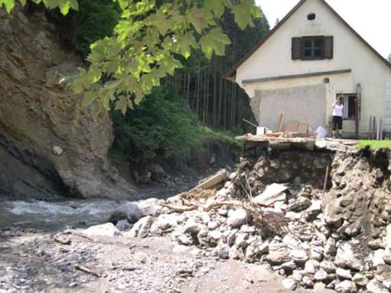
First: A sudden high tide "bites" off a part of a house that was built in the flood zone.
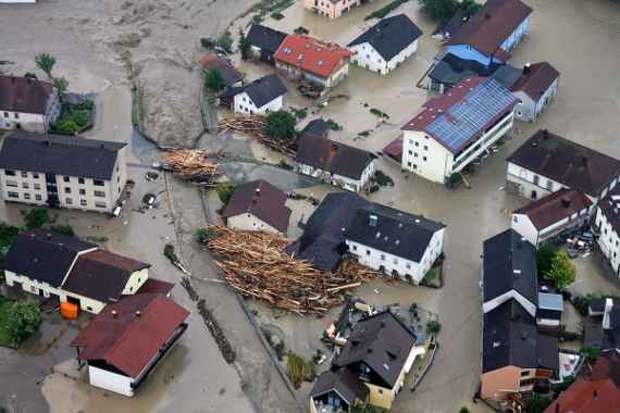
Second: a flood inundates a city, endangers human life and devastates streets, gardens and cellars with huge amounts of sludge.
The flood directive wants Austria's citizens to be better informed about flood risks and to be involved in flood risk management.
The EU Flood Directive ...
... since 2007 flood risk assessment and management in Austria is regulated by the European Union:
- A preliminary risk assessment must identify and describe those areas that have a “potentially significant flood risk”.
- Flood hazard and flood risk maps must be created for these areas and after that
- integrated flood risk management plans with specific goals and measures for the management of the flood risk, in particular through avoidance, protection and precautionary strategies.
These three steps must be repeated every 6 years. All planning is coordinated in the international river basins; the public is informed about all steps and is involved in the preparation of the management plans.
A federal-province working group exists for the technical implementation, consisting of representatives of ALL bodies in the federal and province governments working in flood risk management.
The Flood Risk Management in our ministry responsible for flood protection organizes this hitherto unique cooperation between the provinces' departments in the areas of flood protection, water management, spatial planning and disaster protection, torrent and avalanche control, the Ministry of the Interior (civil protection department, crisis and civil protection management) and the Ministry of Transport (Department of Federal Waterways Administration and via donau) and the Austrian Spatial Planning Commission.
The Institute for Hydraulic Engineering and Calibration of Hydrometrical Current-Meters is involved at the top and works for the Department of Flood Protection in the following activities:
- Working meetings of the federal-province working group
Coordination and decisions on methodologies in flood risk management through coordination of all parties involved: Ministry of the Interior, spatial planning, Ministry of Transport, viadonau, Federal Water Management, torrent and avalanche control, province water management, Federal Environment Agency.
The methodology is developed by sub-working groups:- Sub-working group "Risks"
Drafting and nationwide coordination of the flood risk map methodology - Sub-working group "Hazards "
Drafting and nationwide coordination of the flood risk map methodology, Drafting and nationwide coordination of the methodology Event documentation, Further development and nationwide coordination of the Flood study’s methodology - Sub-working group "Data"
Development of a specialist database in the Federal Environment Agency for all requirements: hazard and risk maps, management plans, event documentation, visualization, interfaces via web map or web feature services, et cetera. - Sub-working group „Surface runoff“
The aim of the surface runoff sub-group is to further develop the surface runoff hazard warning maps. On the one hand, this should be used as a basis for decision-making for the preliminary risk assessment in the context of the implementation of the EU Flood Directive and, on the other hand, it should be used in the context of raising awareness and promoting self-provision. In addition, efforts are being made to homogenize the methods used across Austria in order to avoid contradicting statements.
- Sub-working group "Risks"
- Technical preparation of the regulation on hazard zone mapping in accordance with Section 42a of the Water Act
Current work deals with the technical guidelines for the implementation of the regulation. The development of comprehensible criteria for the delimitation of the so-called functional areas according to the Water Rights Act (red-yellow hatched areas in the hazard zone maps) should be mentioned here in particular. Existing guidelines for determining the red-yellow hatched functional areas, id est those areas that represent significant flow and retention areas, are to be tested for their usability based on of several bodies of water of various sizes and complexity (exempli gratia feeders), improved and simplified, if possible. The work is based on existing studies in cooperation with engineering offices and new ideas that have been developed in the meantime are supplemented. In particular, a pending method verification is planned.


